TopView – Methodology for the efficient use of remote sensing data for climate change adaptation and spatial energy planning
© ThermoSalz © Termatics
The TopView project addresses the challenges of urban energy and heat planning as well as adaptation to climate change. Cities and municipalities face complex tasks that conventional methods often fail to handle adequately. TopView leverages the integration of geoinformation technologies and remote sensing data to provide more precise datasets for planning processes, enabling more efficient and informed decision-making at the municipal and regional levels.
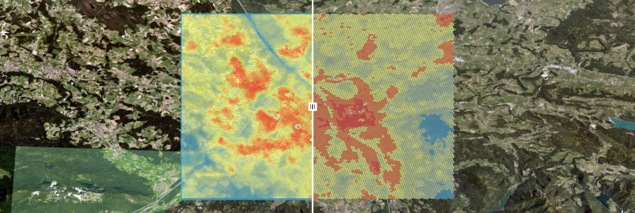
The project aims to develop innovative approaches to spatial energy planning and climate adaptation. To achieve this, it combines thermal satellite images and orthophotos with automated image recognition techniques. This facilitates the detailed analysis of building heat demand, waste heat sources, urban heat islands, and roof shapes and uses. Technical components such as photovoltaic panels, solar thermal systems, or cooling units are identified to unlock potential for renewable energy utilization and improved energy efficiency.
Methodologically, TopView links modern remote sensing with artificial intelligence. The collected data is made accessible to municipalities, energy providers, and other stakeholders to optimize planning processes for energy and climate adaptation strategies.
The results of TopView include high-resolution data layers that precisely map urban heat demand, waste heat sources, and PV expansion potential. These insights promote more efficient energy infrastructure planning and contribute to reducing CO₂ emissions. In the long term, the developed methods aim to enhance the resilience of urban areas to climatic changes.

DI Franz Mauthner, M.Sc.
Key activities:
Spatial Energy Planning and Regional Energy System Analysis